Atlantic Ocean getting hot as hell - could be monstrous hurricane season

Page 13 - Seeking answers? Join the AnandTech community: where nearly half-a-million members share solutions and discuss the latest tech.

balloonshark

Diamond Member
Jun 5, 2008
7,127
3,606
136
Yes, different storm but comparisons are understandable imo.

This storm still has a lot of time to expand its wind field as it weakens.

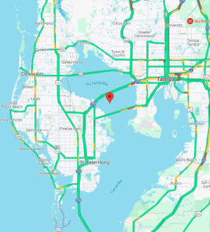
Considering the storm surge potential in a high population area, I can understand why people are making Tampa Bay/New Orleans comparisons.
I was watching a youtuber yesterday and at least two of the models were showing weakening and widening of the windfield from wind shear. He said that would also make for a greater storm surge.

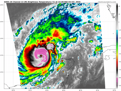
It's pretty amazing how the pressure has dropped from 981 to 911 today and the day isn't over yet.

Edit: Still strengthening.
  • Wind: 180mph
  • Pressure: 905 mb
 
Last edited:

Indus

Lifer
May 11, 2002
15,944
11,103
136
Again, we go back to '05.

Currently, Hurricane Wilma is the strongest Atlantic hurricane ever recorded, after reaching an intensity of 882 mbar (hPa; 26.05 inHg) in October 2005;


It's almost like some people weren't alive before '06.


Oh, and Allen '80 hit 190MPH sustained.

More powerful than any hurricane is the traitors inside the fort!

 
  • Like
Reactions: Brovane

Wreckem

Diamond Member
Sep 23, 2006
9,546
1,125
126
They expect peak intensity to hit overnight then it should weaken but as it weakens its expected to grow dramatically in size.

15’ storm surge possible in Tampa.

Needless to say I’ll be doing something else Wednesday to Sunday. Was supposed to be landing at MCO at 9:30 on Wednesday night, then bumped it to 3:30 on Thursday. Just going to take the Southwest voucher and apply it to my Christmas flight to MCO/Port Canaveral. Everything else is entirely refundable.
 
Nov 17, 2019
13,295
7,875
136
FORECAST POSITIONS AND MAX WINDS

INIT 07/2100Z 21.8N 90.8W 155 KT 180 MPH
12H 08/0600Z 21.9N 89.4W 160 KT 185 MPH
24H 08/1800Z 22.7N 87.4W 150 KT 175 MPH
36H 09/0600Z 24.2N 85.6W 140 KT 160 MPH
48H 09/1800Z 26.1N 84.0W 125 KT 145 MPH
60H 10/0600Z 27.9N 82.6W 110 KT 125 MPH...INLAND
72H 10/1800Z 29.2N 79.5W 75 KT 85 MPH...OVER WATER
96H 11/1800Z 30.5N 71.0W 55 KT 65 MPH...POST-TROP/EXTRATROP
120H 12/1800Z 31.0N 65.0W 40 KT 45 MPH...POST-TROP/EXTRATROP

Ouch.
 

jdubs03

Golden Member
Oct 1, 2013
1,282
902
136
FORECAST POSITIONS AND MAX WINDS

INIT 07/2100Z 21.8N 90.8W 155 KT 180 MPH
12H 08/0600Z 21.9N 89.4W 160 KT 185 MPH
24H 08/1800Z 22.7N 87.4W 150 KT 175 MPH
36H 09/0600Z 24.2N 85.6W 140 KT 160 MPH
48H 09/1800Z 26.1N 84.0W 125 KT 145 MPH
60H 10/0600Z 27.9N 82.6W 110 KT 125 MPH...INLAND
72H 10/1800Z 29.2N 79.5W 75 KT 85 MPH...OVER WATER
96H 11/1800Z 30.5N 71.0W 55 KT 65 MPH...POST-TROP/EXTRATROP
120H 12/1800Z 31.0N 65.0W 40 KT 45 MPH...POST-TROP/EXTRATROP

Ouch.
I’m confident it’s already at 185mph. And honestly it might be 190mph. It’s currently 897mb.
Expect at least that 185mph value at the 7pm CDT/8pm EDT advisory.

I mean look at this.
1728342780437.gif
 

jdubs03

Golden Member
Oct 1, 2013
1,282
902
136
I hope the weakening happens, my mother, brother, and son are all north of Tampa, but further inland.
It looks like it has a bit thankfully, but still at 180mph; though it might be short lived to an eyewall replacement cycle.

My guess is when the after action report is done, the NHC will raise the max winds to 185. A dropsonde measured it right at 185mph.

But unfortunately for track, it does seem like Tampa is in trouble. Hopefully it wobbles away when landfall occurs.
 
  • Like
Reactions: DaaQ

Dave_5k

Platinum Member
May 23, 2017
2,007
3,820
136
FORECAST POSITIONS AND MAX WINDS

INIT 07/2100Z 21.8N 90.8W 155 KT 180 MPH
12H 08/0600Z 21.9N 89.4W 160 KT 185 MPH
24H 08/1800Z 22.7N 87.4W 150 KT 175 MPH
36H 09/0600Z 24.2N 85.6W 140 KT 160 MPH
48H 09/1800Z 26.1N 84.0W 125 KT 145 MPH
60H 10/0600Z 27.9N 82.6W 110 KT 125 MPH...INLAND
72H 10/1800Z 29.2N 79.5W 75 KT 85 MPH...OVER WATER
96H 11/1800Z 30.5N 71.0W 55 KT 65 MPH...POST-TROP/EXTRATROP
120H 12/1800Z 31.0N 65.0W 40 KT 45 MPH...POST-TROP/EXTRATROP

Ouch.
Yeah, ouch, that was a brutal update on forecast. And just pointing out that the coordinates in bold for 125mph inland forecast centerline of the Hurricane - I just mapped it - well, that was technically back over water...
1728347362546.png
 
  • Like
Reactions: Roger Wilco

Lanyap

Elite Member
Dec 23, 2000
8,284
2,380
136
I hope the weakening happens, my mother, brother, and son are all north of Tampa, but further inland.


Our primary home is 45 miles north of Tampa in Hernando county. We’re inland and plan to stay.
 
  • Like
Reactions: DaaQ

Zorba

Lifer
Oct 22, 1999
15,613
11,255
136
Yeah Wilma was quite the storm, incredible in every way. 2005 itself was just something to behold. Katrina at 175mph at peak, Rita at 180mph at peak, and Wilma at 185mph at peak.

And indeed people seem to forget Allen (190mph) and Gilbert (185mph). It’s not like peak intensity wasn’t reached before… Labor Day in 1935 got to 185mph (at least, would’ve been a really interesting to have recon back then). Seems like people have memory holed Irma (180mph), and already Dorian (185mph).

I’m wondering if we’ve seen the peak intensity for Milton at 175mph. There’s some evidence that it could be a bit higher, but that’s not quite supported by flight level winds. It’s a shame we won’t have the hurricane hunters in until three hours from now, will be very interesting to see what the pressure is at that point.

Saw this picture that was really interesting:
View attachment 108835
Edit: attributing credit to splillo on twitter.
I was in Cozumel about 10 months after Wilma and the cruise ship pier was still damaged to the point it couldn't be used. That's one helluva hurricane.
 

DaaQ

Golden Member
Dec 8, 2018
1,988
1,433
136
Yeah, ouch, that was a brutal update on forecast. And just pointing out that the coordinates in bold for 125mph inland forecast centerline of the Hurricane - I just mapped it - well, that was technically back over water...
View attachment 108848
Thanks for that, they are about 1-2 hours north of Tampa. Mom doesn't sound worried.
Our primary home is 45 miles north of Tampa in Hernando county. We’re inland and plan to stay.
That is where they used to live, Hernando close to Pasco county.
 

Zorba

Lifer
Oct 22, 1999
15,613
11,255
136
They expect peak intensity to hit overnight then it should weaken but as it weakens its expected to grow dramatically in size.

15’ storm surge possible in Tampa.

Needless to say I’ll be doing something else Wednesday to Sunday. Was supposed to be landing at MCO at 9:30 on Wednesday night, then bumped it to 3:30 on Thursday. Just going to take the Southwest voucher and apply it to my Christmas flight to MCO/Port Canaveral. Everything else is entirely refundable.
I was on the last Southwest flight out of MCO before Irma hit. Eerie as hell. Got out about 12 hours before the last flight for Dorian. I'm always glad to get out.
 

Puffnstuff

Lifer
Mar 9, 2005
16,197
4,881
136
I watched a video this morning from people evacuating the area and gas stations have already gone dry and closed along with massive traffic jams which means that people are heeding the warnings. Hopefully the FHP will make all lanes one way to help move traffic out of the area.