
- Jun 4, 2004
- 17,757
- 16,102
- 146
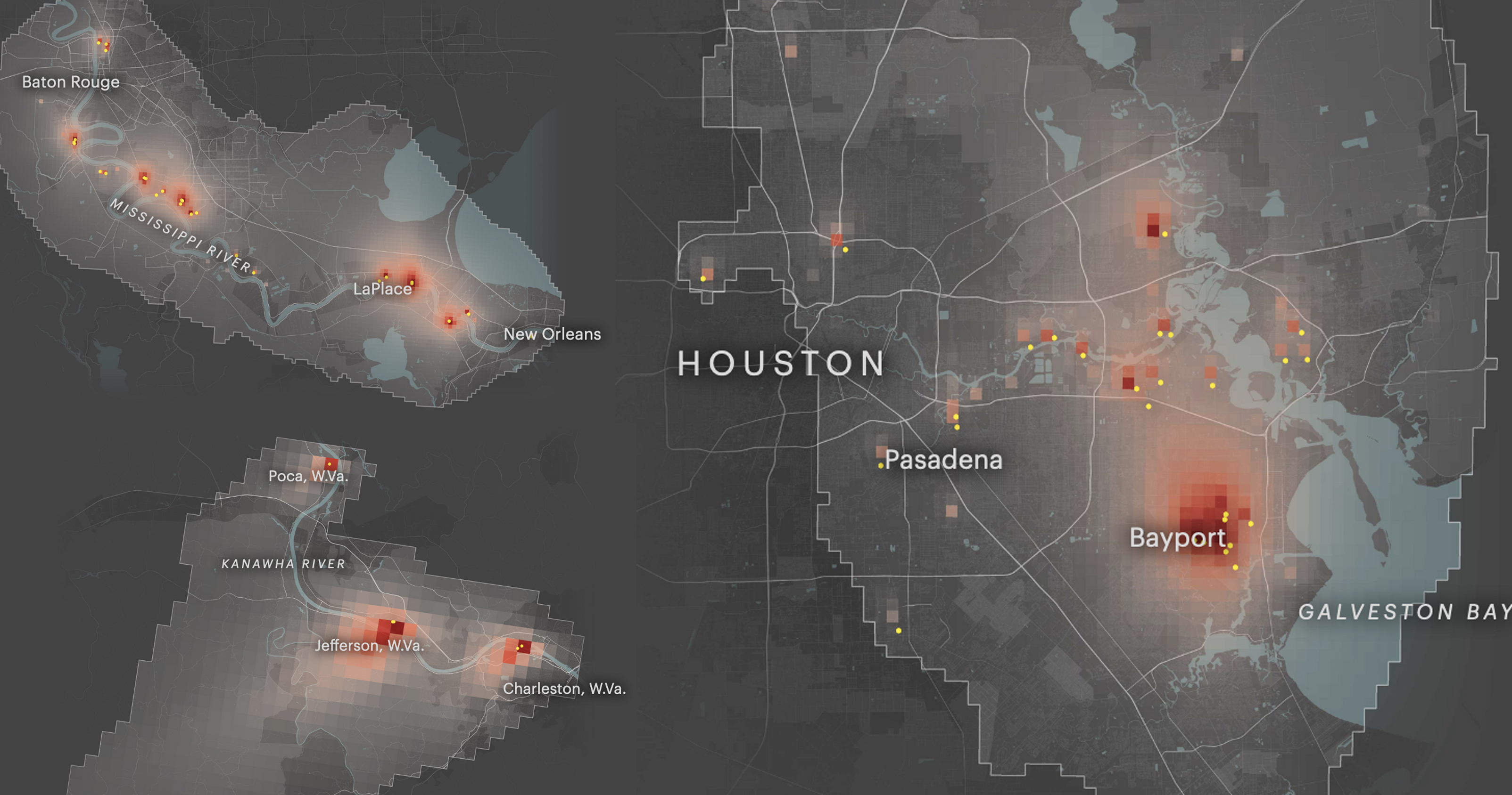
The Most Detailed Map of Cancer-Causing Industrial Air Pollution in the U.S.
Using the EPA’s data, we mapped the spread of cancer-causing industrial air emissions down to the neighborhood level. Look up your home to see if you and your loved ones are living in a hot spot.
projects.propublica.org
This is pretty cool. Plug in your zip code and see how much of a risk increase in cancer from air pollution you have.
EPA accepted air pollution/cancer risk is a risk increase of 1 in 10,000
Heres a pic of Houston for example.

